
Scan To 3D
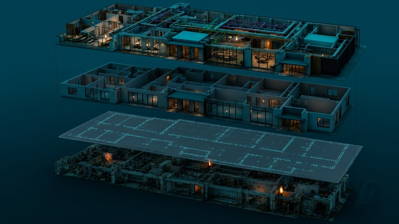
Transform your raw laser scan and point cloud data into accurate, high-fidelity 3D CAD, Revit, or textured mesh models. We convert client-provided scans into design-ready geometry for renovations, digital twins, and architectural workflows.
Overview
Expert 3D modeling from client-provided scan data — We specialize in converting raw laser scan data and point clouds provided by our clients into precise 3D geometry, architectural models, and intelligent CAD/BIM assets. Our experienced modeling team delivers structured, design-ready deliverables customized to your specific tolerances and formatting standards.
Example outputs
Sample 01 / 11
Client confidentiality
All project samples are shared with client permission. We treat every dataset as confidential and never disclose client data.
Want to explore further? Get in touch or schedule a meeting to help build trust.
How we do it
- 01Data Intake & AuditWe receive your raw point clouds or scan datasets, verifying file formats, coordinate alignment, and detail requirements before modeling begins.
- 02Point Cloud SetupOur team aligns, filters, and prepares your scan files in our specialized design environment to ensure optimum performance and model precision.
- 03Precision 3D ModelingOur expert draftspersons and modelers extract geometry and build structures, MEP runs, terrain, and architectural features directly over your registered scan data.
- 04BIM Attribution & ParametricsWe enrich the geometry with metadata, parametric families, and specified attribute detailing per your target LOD and design standards.
- 05QA & VerificationEvery 3D model is clash-checked, verified for dimensional accuracy against the source point cloud, and delivered in your preferred file format.
Use cases
- Outsourced point cloud-to-BIM modeling
- As-built modeling from third-party surveys
- BIM coordination and clash detection preparation
- Converting laser scans to design-ready CAD assets
- Mesh optimization and texturing for digital twins
Deliverables
- Parametric BIM models (Revit, IFC)
- 3D CAD models (DWG, DXF, DGN)
- Textured 3D meshes (OBJ, FBX, GLTF)
- As-built drawings and floor plans
- Clash detection and deviation reports
Continue exploring
Terrestrial Laser Scanning & 3D Modelling