
Road Corridor Mapping
Survey-grade and engineering-grade mobile LiDAR mapping for accurate roadway geometry, corridor features, and design-ready geospatial data.
High-accuracy road corridor mapping from mobile LiDAR
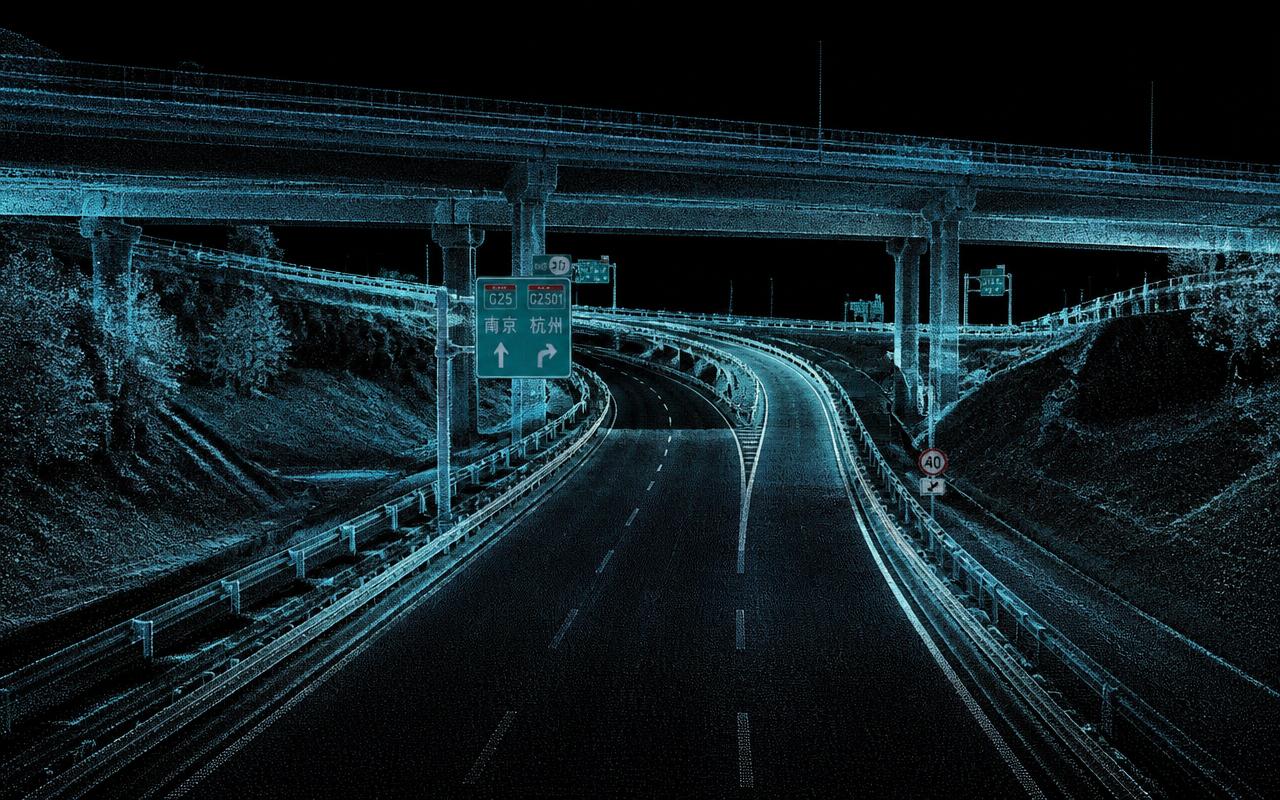
VMAPStech processes mobile LiDAR data to create accurate 2D and 3D representations of road corridors, capturing roadway geometry and key infrastructure features.
Our workflows map lane markings, traffic signals, utilities, barriers, signage, intersections, roundabouts, and ramps, delivering structured data to support road widening, resurfacing, and new construction design.
All project samples are shared with client permission. We treat every dataset as confidential and never disclose client data.
Want to explore further? Get in touch or schedule a meeting to help build trust.
- 01LiDAR Point Cloud Processing
We process high-density mobile LiDAR point clouds to establish an accurate 3D representation of the roadway and surrounding corridor.
- 023D Line Map Creation
Roadway geometry is extracted from the LiDAR data to create detailed 3D line maps, including pavement edges, lane geometry, curbs, medians, and other defining corridor features.
- 03Roadside Feature Mapping
Key corridor assets are identified, extracted, and georeferenced, including lane markings, traffic signals, utilities, barriers, signage, and other visible roadway features.
- 04Complex Roadway Geometry
Detailed mapping is performed for intersections, roundabouts, ramps, and connecting road sections, capturing the geometry required for engineering and infrastructure applications.
- 05Engineering-Ready Deliverables
The completed corridor dataset is prepared in structured CAD, GIS, and 3D formats, supporting road widening, resurfacing, rehabilitation, and new construction design.
- Highway & arterial road mapping
- Road widening & resurfacing
- New construction & engineering design
- Intersection, roundabout & ramp mapping
- Pavement & roadway analysis
- Corridor asset management
- Structured outputs for CAD, GIS & engineering workflows
- 2D / 3D Road Corridor Mapping
- Classified Point Clouds — LAS / LAZ
- Pavement, Curb & Lane-Edge Breaklines
- Corridor DTM / DSM
- Engineering Drawings — DWG / DGN
- GIS Feature Layers
- Georeferenced Panoramic Imagery
- QA/QC & Completeness Report
Support both survey-grade and engineering-grade mapping requirements based on project specifications.
Work with experienced survey partners for high-quality field acquisition while our in-house team manages processing and production.
Our team combines LiDAR, GIS, CAD, imagery, and transportation mapping expertise to create production-ready datasets.
Advanced processing workflows accelerate the extraction of roadway features and assets from large point-cloud datasets.
From individual urban corridors to thousands of kilometers of roadway, our workflows are designed for scalable production.
Receive data in the formats your engineering, GIS, design, or asset-management teams already use.
Have a roadway or corridor to map?
Tell us your corridor length, LiDAR data, mapping specification, and required deliverables. We'll help define the right processing and production workflow.
Discuss a project