
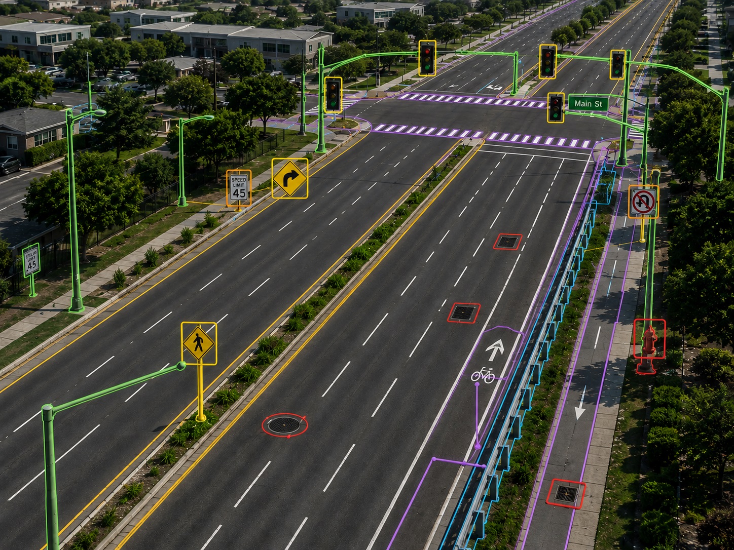
Asset Extraction
Transform roadway imagery, video, database information, and project specifications into accurate, structured geospatial asset data for transportation infrastructure, asset management, and roadway analysis.
All project samples are shared with client permission. We treat every dataset as confidential and never disclose client data.
Want to explore further? Get in touch or schedule a meeting to help build trust.
- 01Data Preparation & Project ReviewReview SQL database files, roadway imagery, videos, project specifications, and project start/end locations. The source data is assessed against the required asset definitions, attributes, coordinate information, and extraction specifications before production begins.
- 02Asset ExtractionIdentify and extract roadway and infrastructure assets from imagery and video sources using the required project classification and attribution standards. Assets are captured according to their spatial characteristics and classified as point or linear features.
- 03Point & Linear Asset MappingCapture point assets at their specific geotagged locations and linear assets using defined start and end locations. The workflow can include signs, ramps, signals, utility features, turn lanes, sidewalks, guardrails, curbs, bike lanes, pavement markings, and other roadway features.
- 04Quality Control & ValidationPerform systematic checks for duplicate assets, incorrect locations, missing features, incorrect attributes, and database field completeness. Extracted information is reviewed against source imagery and project specifications to identify and correct inconsistencies.
- 05Quality Assurance & Final DeliveryConduct final completeness reviews, random sample checks, specification validation, and attribute verification before delivery. Validated asset data is prepared in the required database structure and delivery format.
- Roadway & highway asset inventory
- Transportation infrastructure management
- Road maintenance & planning
- Traffic sign & signal inventories
- Pavement marking & roadway feature mapping
- Pedestrian & bicycle infrastructure mapping
- Utility & roadside asset inventories
- GIS database development & asset management
- Asset-Extracted Database
- Point & Linear Asset Data
- Geospatial Asset Locations
- Asset Attributes & Classification
- QA/QC Validated Dataset
Experience supporting extensive roadway analysis and asset extraction programs across thousands of linear miles.
Extract a broad range of roadway, transportation, utility-related, and infrastructure assets according to project specifications.
Capture both discrete point features and continuous linear assets with appropriate spatial geometry and attribution.
Integrate imagery, video, SQL databases, project specifications, and geographic project information into a coordinated workflow.
Quality control and quality assurance are incorporated into production to help maintain consistent and reliable asset datasets.
Work according to client-defined asset classifications, database fields, attribute requirements, and delivery specifications.
Ready to turn roadway data into structured asset intelligence?
Accurate asset extraction, classification, and QA/QC—built to your project specifications.
Discuss a project