
3D Feature Extraction & Modelling
Building footprints, breaklines and CityGML LOD1 / LOD2 models digitised directly from client-supplied aerial LiDAR — accurate, attributed and ready for engineering, planning and digital-twin use.
We turn client-supplied aerial LiDAR into decision-ready 3D basemaps — every building footprint, road edge, breakline and utility feature is vectorized, attributed and delivered in the schemas your engineering, planning and digital-twin platforms already speak.
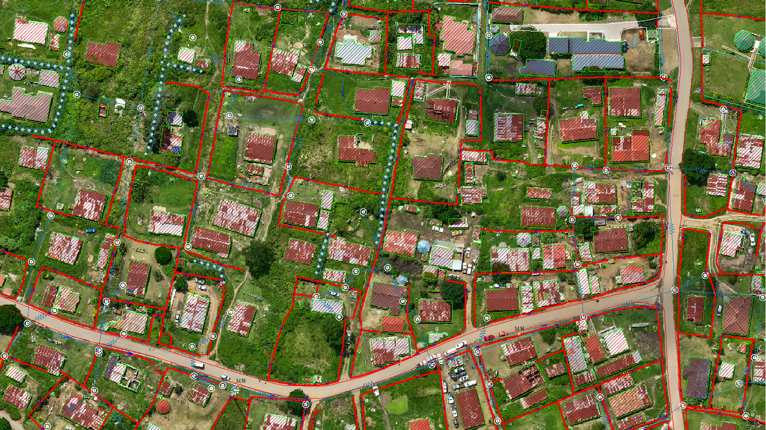
Aerial LiDAR flythrough showing vectorized buildings, roads and breaklines derived from the classified point cloud.
All project samples are shared with client permission. We treat every dataset as confidential and never disclose client data.
Want to explore further? Get in touch or schedule a meeting to help build trust.
- 01Source data intake
Classified LiDAR, ortho imagery and — where available — oblique imagery are ingested and co-registered on a common datum and projection so every extracted feature sits on ground truth.
- 02Planimetric extraction
Building outlines, roads, curbs, driveways, water bodies, walls and fences are digitized to the client's feature catalogue with tolerances matched to the intended CAD / GIS scale.
- 03Breaklines & surface conditioning
Hard and soft breaklines — ridges, toe-of-slope, edge-of-pavement, streams — are digitized and integrated with the terrain model so downstream hydrology, grading and design behaves realistically.
- 043D building modelling (LOD1 / LOD2)
Prismatic LOD1 shells or roof-form LOD2 models are generated per CityGML, with heights, roof pitch and eaves derived from the point cloud and validated against imagery.
- 05Attribution, QA & delivery
Every feature is attributed, topology-checked and reviewed against imagery. Deliverables ship in DGN, DWG, SHP, GeoPackage, CityGML, glTF or IFC with a documented QA report.
- Smart-city and digital-twin basemaps
- 5G / telecom RF planning and line-of-sight studies
- Solar suitability and rooftop analysis
- Urban planning, zoning and change detection
- BIM–GIS integration and infrastructure design
- Vector planimetrics — buildings, roads, hydrology, hardscape
- Breaklines integrated with the terrain surface
- LOD1 / LOD2 3D building models (CityGML, glTF)
- Utility, fence and wall feature layers
- Attributed feature classes in DGN / DWG / SHP / GeoPackage
- QA report with feature counts, tolerances and lineage