
VMAPS Technologies offers wide range of services to its customers across globe which includes but are not limited to

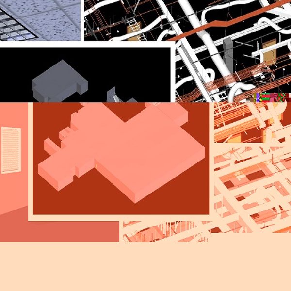
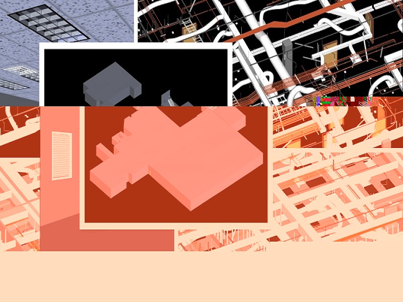
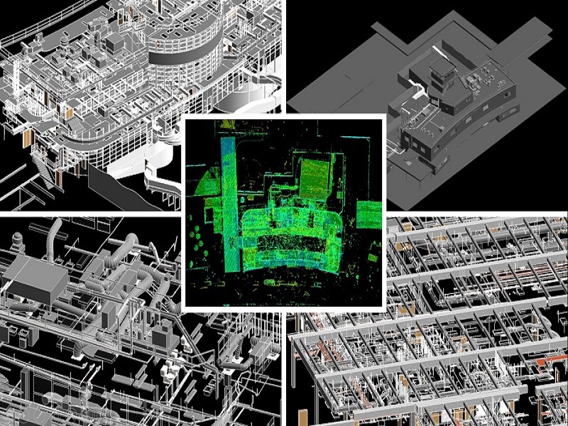
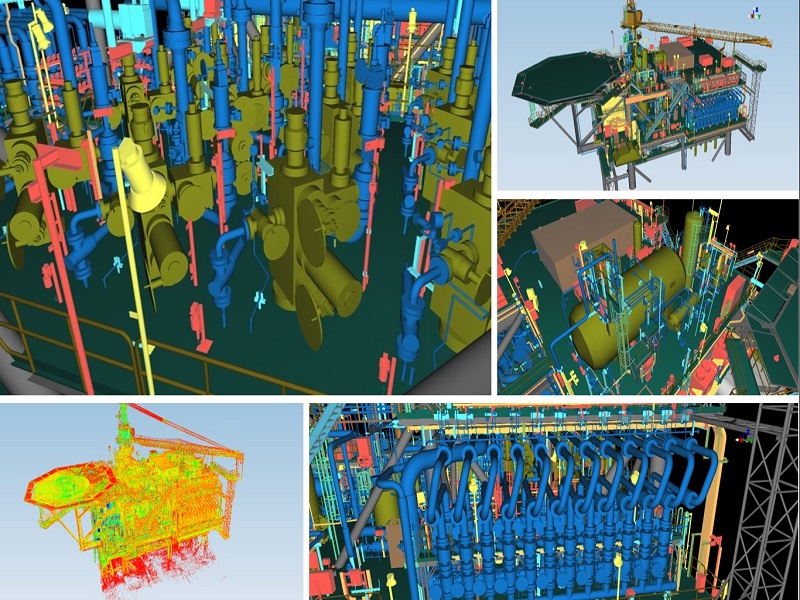
TERRESTRIAL LASER SCANNING AND 3D MODELLING SERVICES
Being an early mover in 3D Modelling and Building Information Modelling (BIM) technologies VMAPS proudly has customers servicing Aviation, Oil & Gas, Process Industries, Large Public and Commercial Buildings, Brownfields Industrial Facilities, Construction and Heritage industries.
Our 3D Laser Scanning and Modelling Services provide value throughout the planning, design and execution phases of the project. We provide as-built environment models for facilities management, architects, engineers, and construction professionals. Our in-house team of engineers, architects and BIM/CAD designers convert the captured registered point cloud data into the deliverables by working closely with each client to develop an accurate understanding of the existing conditions and create custom deliverables of your choice, from point cloud and true view images to AutoCAD 3D Models, Revit 3D Models and 2D AutoCAD files. We provide an accurate model with accuracy of +/- 6mm and to your exact specifications. VMAPS has capabilities to deliver all types of data formats and a variety of modelling products.
Our Services Include:
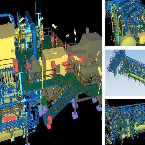
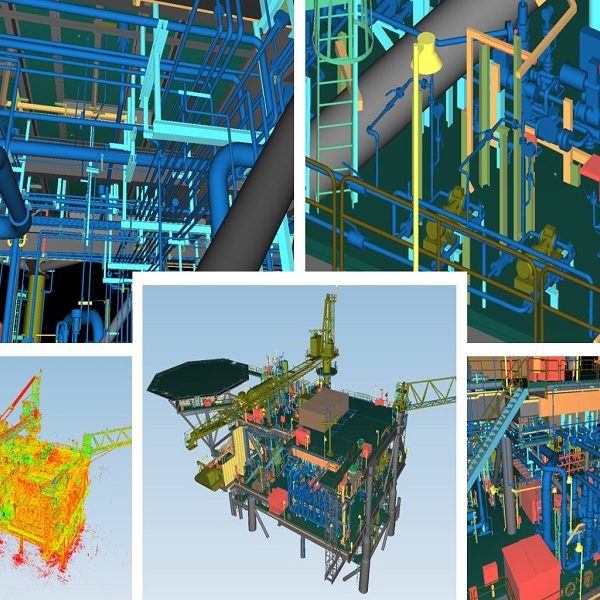
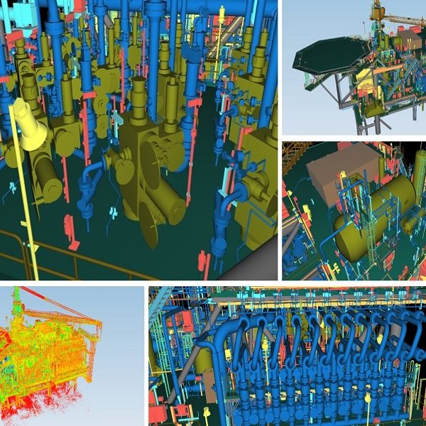
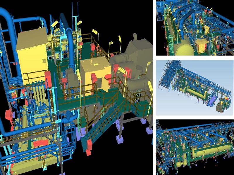
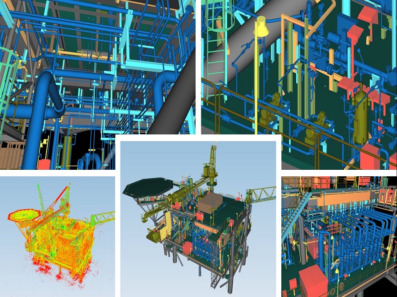
– Plant Engineering Modelling Services for
o Retrofit
o Onshore & Offshore Plants
o FPSO
o Refinery Plants
o Process Plants
– BIM Modelling Services (Architecture, Structure and MEPF) for
o Airport Modeling
o Hospitals and Schools
o Architectural Buildings
o Industrial Process Plants
o Cultural Heritage
– Infrastructure Modelling (Substation, Bridges, Tunnels, etc.)
– 2D Plans, Sections and Elevation Modelling
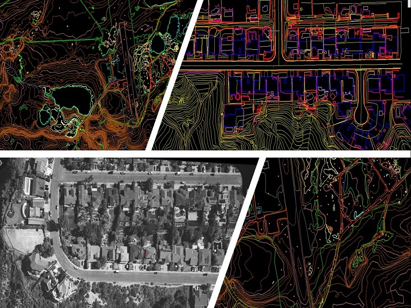
AERIAL IMAGE PROCESSING / DIGITAL PHOTOGRAMMETRY SERVICES
We are a trusted provider of digital photogrammetry services such as Aerial Triangulation, Large/Small Scale Mapping, Orthophoto generations, and 3D City Modelling. Our photogrammetry services enable clients to get highly accurate map and spatial data that supports urban, transportation and operational planning. We deliver location-based services for our global clientele to meet their diverse business requirements efficiently by leveraging our expertise in multiple sensor technologies.
Services offered include:
- Aerial Triangulation
- DEM/DTM Generation
- Stereo-Compilation / Restitution
- Topographic and Planimetric Feature Extraction (2D and 3D), Contour Generation
- Orthophoto Services (Colour Balancing, Mosaicking and Tile Generation)
- 3D City Modelling (LOD 100, 200 and 300)
- 3D Data Migration to Geo-database
- UAV Image Processing (AT, DTM, Orthophoto)
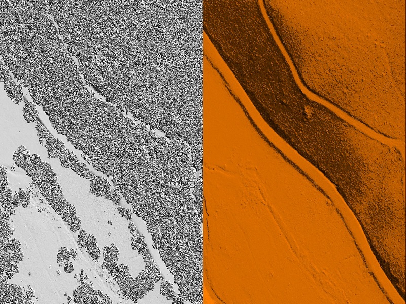
AIRBORNE LIDAR DATA PROCESSING
Aerial LiDAR typically involves scanning from an airplane or helicopter fitted with suitable laser scanner and is usually carried out for mapping large areas. VMAPS partners with expert Aerial LiDAR survey companies for aerial laser scanning and have an in-house team of experienced aerial LiDAR processing professionals. VMAPS has rich experience in aerial LiDAR classification projects for Mines, Forests, City and Corridor Power Lines, Roads, Railways, Coastline and Pipeline.
Services offered include:
- Power Line Classification including Sag Analysis
- Flood Mapping
- Classification of Bare Earth and Above Ground Features ( vegetation, buildings, bridges)
- 3D Feature Extraction and Modelling
- Contour Generation
- Creation of DSM, DEM, Intensity images
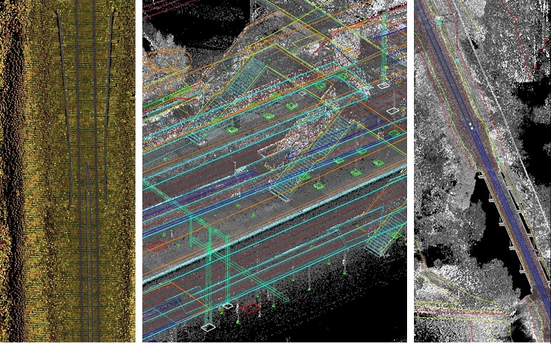
MOBILE LIDAR DATA PROCESSING
We have a competent team with skills to perform data processing, feature extraction and CAD output generation.
We offer following services and deliverables for Mobile LiDAR projects:
- Highway and Corridor Mapping
- Asset Mapping
- As- built drawings
- 3D Modelling and Simulation
SATELLITE IMAGE PROCESSING
VMAPS offers remote sensing services to its clients worldwide. VMAPS’s expertise in remote sensing branches out to meet classification, image correction, image enhancement, image processing, and change detection services. We have experience working on various satellite sensors such as IKONOS, QuickBird, CARTOSAT, World View 1 and 2. Our experience ranges from updating topographic, hydrological, and man-made infrastructure data sets in preparing comprehensive GIS base map with features. These features include outlines of buildings, agricultural farms, road networks, and other select man-made structures. Our technical teams are hands-on in using complete suites of remote sensing software’s like ERDAS IMAGINE, ENVI, and ER Mapper, etc.
Services offered include:
- Satellite imagery interpretation and classification
- Change Detection
- Land Cover Classification
- Forestry Mapping, Agricultural Mapping, and Mining and Geology Mapping
- Clutter Data for Wireless Telecommunication Network Planning
How to contact us
If you’ve got questions or ideas you would like to share, send a message. For anything more specific, please use one of the addresses listed below.